News
New AI Promises Ships Safer Passage While Traversing Arctic Seas
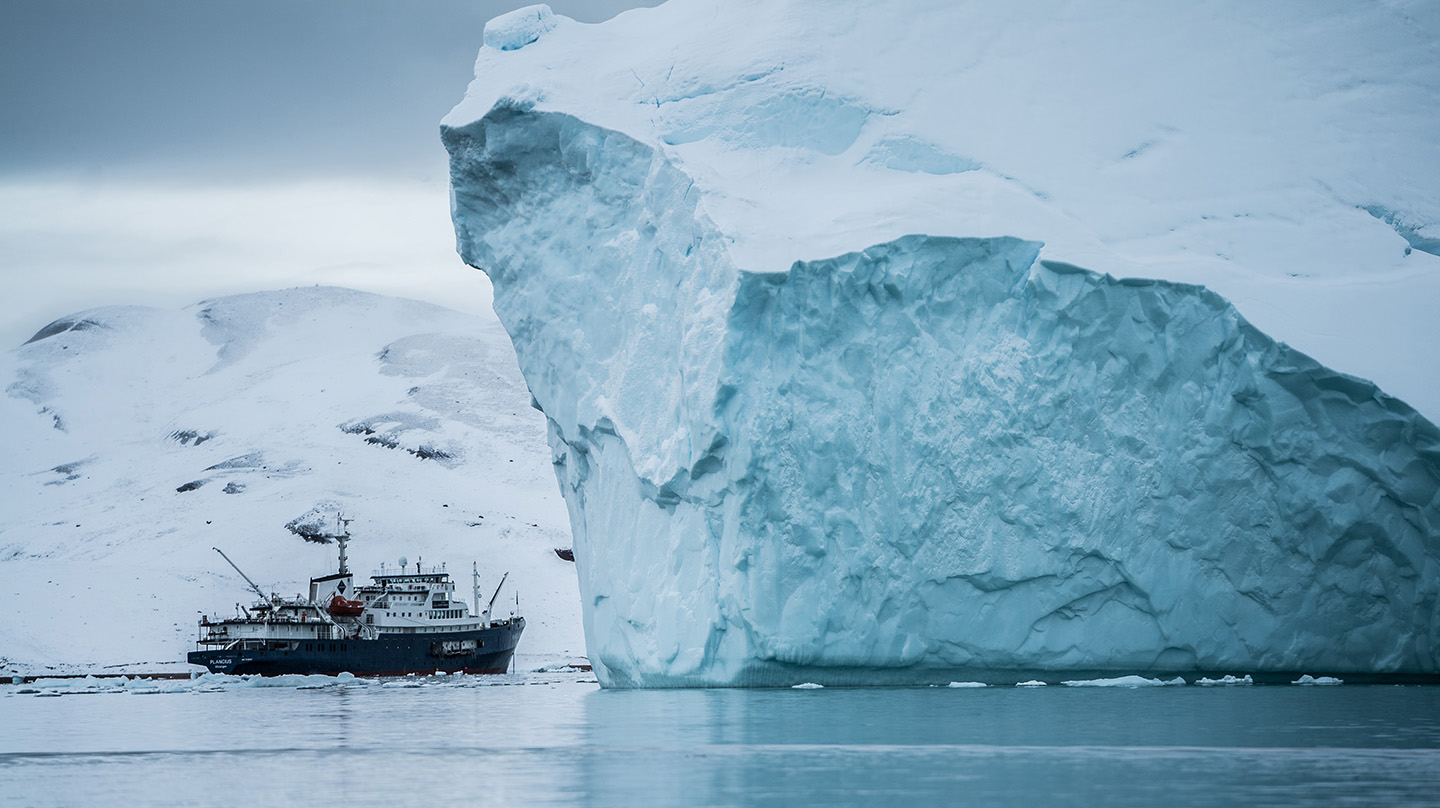
A vessel passes by icebergs near Greenland. With the Arctic melting faster than any other part of the world, seaways once blocked by ice are becoming traversable. A new artificial intelligence model that forecasts the extent of sea ice will help commercial and military ships navigate the region safely.
Photo by Hubert Neufeld on Unsplash.
Scientists at the Johns Hopkins Applied Physics Laboratory (APL) in Laurel, Maryland, have developed a tool that can predict where and when sea ice will form around parts of the Arctic from one to seven days beforehand.
The new model, which relies on artificial intelligence (AI) and machine learning, proved up to 97% accurate against real-world data. The result underscores the tool’s promise to address the growing need for precise and timely sea ice forecasting as the world’s northern seas begin to bustle with traffic.
The research team will highlight their model and results at the upcoming Research Frontiers Forum on Climate Change and National Security held at APL on June 8.
While climate change’s effects are being felt worldwide, they’re particularly acute in the Arctic. Temperatures there have been climbing four times faster than the global average, according to a 2022 study, and from 1979 to 2023, the maximum extent of the region’s sea ice every March has steadily dropped by 2.5% per decade, according to the National Snow and Ice Data Center.
The lost sea ice portends dramatic changes to the world economy as previously ice-blocked sea routes begin to thaw and ships pass through more frequently. In 2020, the Arctic Council reported a 25% increase in the number of ships transiting Arctic waters from 2013 to 2019. Most were fishing vessels, icebreakers, or research vessels, but even tourist groups have been sailing through. In 2019 alone, 73 cruise ships crossed Arctic waters.
Having more ships in the Arctic raises the chances that one (or many) is caught unprepared during the months that ice pack forms and melts. Mary Keller, an APL remote sensing scientist and the project lead, is keenly aware of that impending risk.
“In many ways, sea ice is a brave new world,” she said. “The ice is thinning, and precipitation is changing from snow to rain. Both will accelerate the seasonal spring/summer sea ice melt, which is beginning, on average, about a week earlier every decade, with increased openings into the pack ice. Currents and winds will set that ice in motion, so areas that appear clear in satellite imagery can be ice-blocked just a day or two later, spelling trouble for ships that thought they were on a safe course through a strait or bay.”
Ships will need near-term sea ice forecasts to ensure they can safely pass through, but according to Keller — a former sea ice analyst at the U.S. National Ice Center — what is currently available is not up to the challenge.
“It’s as inaccurate as weather forecasting had been in, say, the 1970s,” she explained.
Current ice tracking methods at the National Ice Center rely on an intensive process involving several analysts manually clicking tens of thousands of points along the ice’s edge in satellite images. They then incorporate the longitude and latitude coordinates of the points into a geographical information system to create maps they can deliver to interested parties. While the Ice Center is producing daily 48-hour forecast maps for certain regions of the Arctic, the resolutions are still too low to route ships.
Keller and APL computer scientist Christine Piatko, the project co-lead, decided to try leveraging AI and machine learning to both update and hone forecasting capabilities. In line with APL’s growing interest in developing AI for climate intelligence and national security purposes, the project offered the capability both to couple environmental variables that, to a human, may not clearly connect and to develop the intuition an analyst would need and use to make a forecast.
The team created a machine-learning model that could generate daily sea ice forecasts out to seven days and with 1-kilometer resolution. They trained the AI using data and forecasts from several atmospheric and oceanographic models of the Beaufort Sea north of Alaska, including ocean currents, sea surface temperature, winds and sea ice extent during the freeze-up period (September to November) in 2016 and 2018-2020.
The resulting system proved strikingly accurate. Compared with real-world sea ice data, the team’s model could predict sea ice extent with 97% to 93% accuracy at one and seven days out, respectively.
In one highlighted example from Oct. 24 to 26, 2019, the model predicted the closure of sea ice above the Northwest Territories in Canada within one day of when it actually occurred. Because the model also showed the potential for ice formation on the correct date, the researchers say it would have provided sufficient information for any ships to pass through safely.
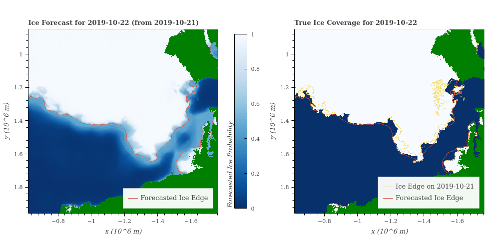
A seven-day forecast of the sea ice extent (left) versus the true sea ice extent (right) in the Beaufort Sea north of Alaska from Oct. 22, 2019, to Oct. 28, 2019. The forecast was generated using a new artificial intelligence model and closely matched the actual extent of the ice, with up to 97% accuracy.
Credit: Johns Hopkins APL/Mary Keller/Christine Piatko
Although initially successful, the model still has much room to improve, Keller and Piatko noted. Particularly noteworthy is ensuring the machine-learning model is grounded in the real world.
“While the stack model accounts for the data, there’s no guarantee it’s following the physics,” Piatko said. “There’s currently no built-in knowledge to say what it’s doing is sensible.”
A follow-up project is trying to rectify that issue for at least part of the short-term forecasting. The team is using a physics-informed neural network (PINN) — a relatively new type of deep learning framework that includes the governing physical equations believed to control the interrelationships of data sets. Given the complexity of such models, the group is starting small, trying to forecast just sea ice movement in the Greenland Sea, where the East Greenland Current strongly forces ice drift. If successful, the method could provide a powerful avenue for training the entire sea ice-forecasting model.
To learn more about APL contributions to climate and national security challenges, visit https://www.jhuapl.edu/work/projects/climate-security.