Press Release
The Johns Hopkins University Applied Physics Laboratory Licenses Flight Navigation Software Technology
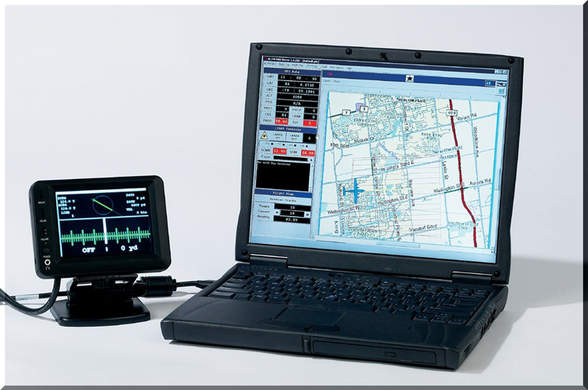
Pilot Display on a 5-inch LCD screen and Primary Operator Interface on a standard notebook
Tue, 02/12/2002 - 12:01
The Johns Hopkins University Applied Physics Laboratory (APL), Laurel, Md., has exclusively licensed its “Rapid Terrain Visualization, Navigation Planning, and Flight Management” (APL-NAV) software package to Optech Inc. located in Toronto, Canada and Stennis Space Center, Miss., for use in their Airborne Laser Terrain Mappers (ALTMs).
APL-NAV is a fully integrated flight management package that can graphically plan surveys on user-configurable maps, control system hardware, provide real-time navigation, track real-time coverage, manage pilot displays, and provide operator training.
Optech’s ALTMs are used for rapid, high-accuracy, topographic survey applications. “The modular, easily adaptable APL-NAV software package allows for cost-effective planning and project estimating, and the real-time monitoring of system status and performance ensures economical survey coverage,” says Bill Gutelius, Optech’s Government Relations Manager. “Two Optech ALTMs systems, configured with the APL-NAV software, are already on track for sale this quarter.”
“Transferring technology originally developed for the Department of Defense to the civilian business sector is good for industry, the inventors and the U.S. government,” says Kristin Gray, Deputy Director of APL’s Technology Transfer Office. Kevin Murphy, an engineer at APL, developed the software for the U.S. Army to assist in planning and executing aerial photography and mapping.